
Trace a Guilford County Street Directory
Guilford County keeps address clues in separate systems. The practical chain is address → parcel → GIS road and address data → deed and legal description → voter status → historical reverse directory. It starts with the physical address, not a broad name search. The tax listing connects that address to a parcel, owner name, mailing address, and legal description. GIS then supplies map context. The deed index can carry the land trail backward, while a voter record or old reverse directory may support a narrower, time-bound observation.
- Enter the full address in the Guilford County Real Property Listing search and copy the parcel number or REID, owner name, situs address, mailing address, and legal description that appear.
- Use county GIS or Parcel Research to place the parcel on its road segment and inspect nearby parcels, the postal community, municipal context, and district layers.
- Search the current owner as grantee in the Register of Deeds index. Compare the deed's legal description, book or document reference, and grantor with the parcel record.
- Use the name-driven NC Voter Search only to check a registration record within its stated limits. It is not a street-wide household roster.
- For an older address question, consult a criss-cross directory, which arranges historic directory entries by address rather than by surname.
Each handoff matters. Parcel and legal-description fields are more durable joins than a typed street label, especially where a road name, number, postal community, or municipal boundary has changed.
Guilford County Assessor Search Tips
The Guilford County Real Property Listing offers Parcel Number, Owner Name, and Address modes. Its own guidance favors a full address such as 515 Smith St. Parcel numbers take up to seven digits with no leading zeroes. For a name, use the first three letters and favor Last, First; a comma can restrict a name search to the last name. An address number by itself is deliberately broad, so 515 can also find 5515 or 5153.
| Visible field | Input type | Required | Guilford format or tip |
|---|---|---|---|
| Search type | Choice control | Yes | Parcel Number, Owner Name, or Address. |
| Parcel Number | Text | When selected | Up to seven digits and no leading zeroes. |
| Owner Name | Text | When selected | Use the first three letters; Last, First is the preferred format. |
| Address | Text | When selected | Use the first three street letters or address digits. A full address is more precise. |
| Result or property card | Link or list | No | The 2025 listing form links to a property record card. |
Insider tip. A full address and the Last, First format avoid the broad partial-match behavior the assessor describes. The card may lead to the current owner, situs, mailing address, legal description, parcel number or REID, and listing information. The research capture did not verify every card label, sort option, or page of results, so those fields should not be assumed beyond the listed inventory.
The county address-points service shows the address-oriented data model used in Guilford County.
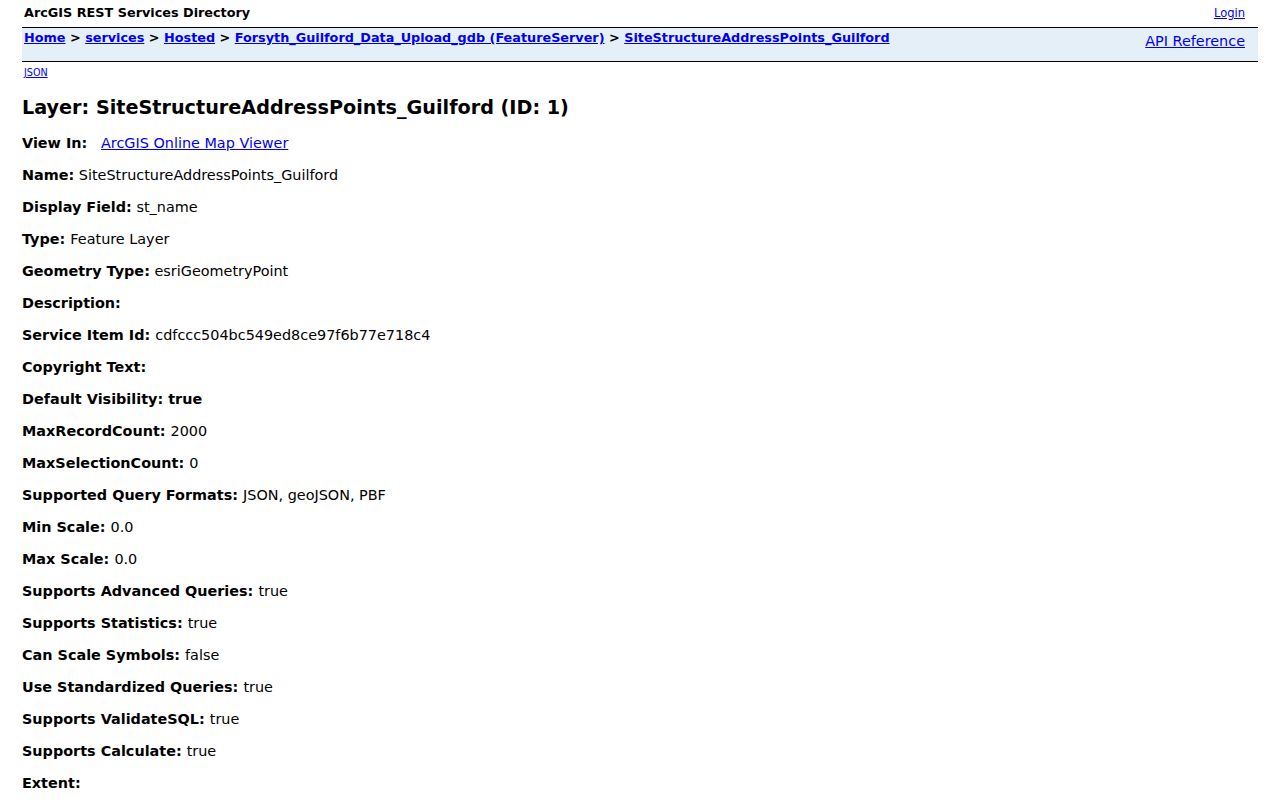
Address-point fields can include a unit, floor, room, ZIP+4, jurisdiction, and placement information. They identify an address point and its geography, not every person connected with it.
Guilford County Parcels Along Streets
Parcel Research and the county GIS tools add the map context that a tax card cannot. Begin with the parcel ID and legal description, then pan or identify adjoining parcels and the road segment. The visible Parcel Research controls include an operator, a search-category control, a criteria field, Add to Search, Perform Search, Help, and Export to CSV. Results display 150 records at a time. Its rendered interface did not disclose the category labels, so it is accurate to describe the query structure but not to promise a named ZIP, owner, or street-category choice.
The Parcel Research application provides the query and export surface used for parcel context.
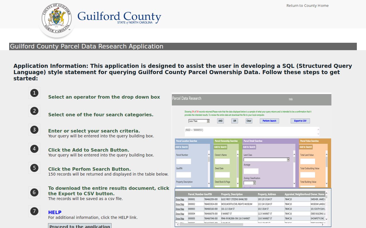
Use the map to compare parcel geometry and road frontage before treating similar street names as the same place. The application also warns that current tax-system records change daily and are supplied without warranties.
- Parcel
- A mapped unit of land used by the tax system. Its number or REID is often a stronger match than a street spelling.
- Situs address
- The physical location of the property. It differs from the address where a tax bill is sent.
- Plat
- A recorded map that can show a lot, block, subdivision, easement, or road layout.
- Criss-cross directory
- A historical directory arranged from address to listed occupant or business, subject to its own coverage and spelling limits.
Guilford County Street Directory Records
Address-keyed sources answer different questions. A property record can show ownership and tax correspondence. GIS shows parcels, roads, ZIP context, municipal context, and districts. Deeds show a recorded transfer chain. Permit data dates a project. A voter file can support a registration check when lawfully accessed. None of these is a complete list of everyone at a house, so the Guilford County street directory works best when each source remains in its own lane.
| Address-keyed record | County keeper | What it can establish | Access route |
|---|---|---|---|
| Property listing or card | Tax Department | Owner, parcel, situs, tax mailing address, legal description, and listing details. | Free owner, address, or parcel search. |
| Parcel and GIS layers | County GIS | Geometry, adjacent parcels, roads, ZIP, municipality, districts, and enabled layers. | Public viewers, REST services, and Parcel Research. |
| Deed index and image | Register of Deeds | Grantor, grantee, instrument, book or page, recording, legal description, and linked image when available. | 1771-forward index/image claim, office, and microfilm routes. |
| Permit record | City or county inspection custodian | Permit type, work class, address, square feet or value, and application or final dates. | Jurisdiction-specific portal or request. |
| Voter data | State or county elections | Registration status, precinct, and other statutory public fields. | Name-driven lookup or official data-request route. |
Use the parcel number or REID to join a card, map, and deed trail. A street label joins less reliably because a deed can describe a lot and block rather than a house number. For past household evidence, the Guilford County city directory collections hold the historical address-first material rather than the current tax record.
Guilford County Road Sides and ZIPs
One road can carry two address geographies. The RoadCenterlines schema stores postal code, postal community, ESN, MSAG community, and incorporated or unincorporated community separately for the left and right sides of a segment. It also has street name, type, direction, legacy name and type, road class, one-way status, speed limit, validation, agency, effective and expiration dates, Master Street Name ID, and private or public use. That explains why two nearby addresses can have different postal or public-safety context.
The RoadCenterlines service exposes the county schema behind those left and right attributes.
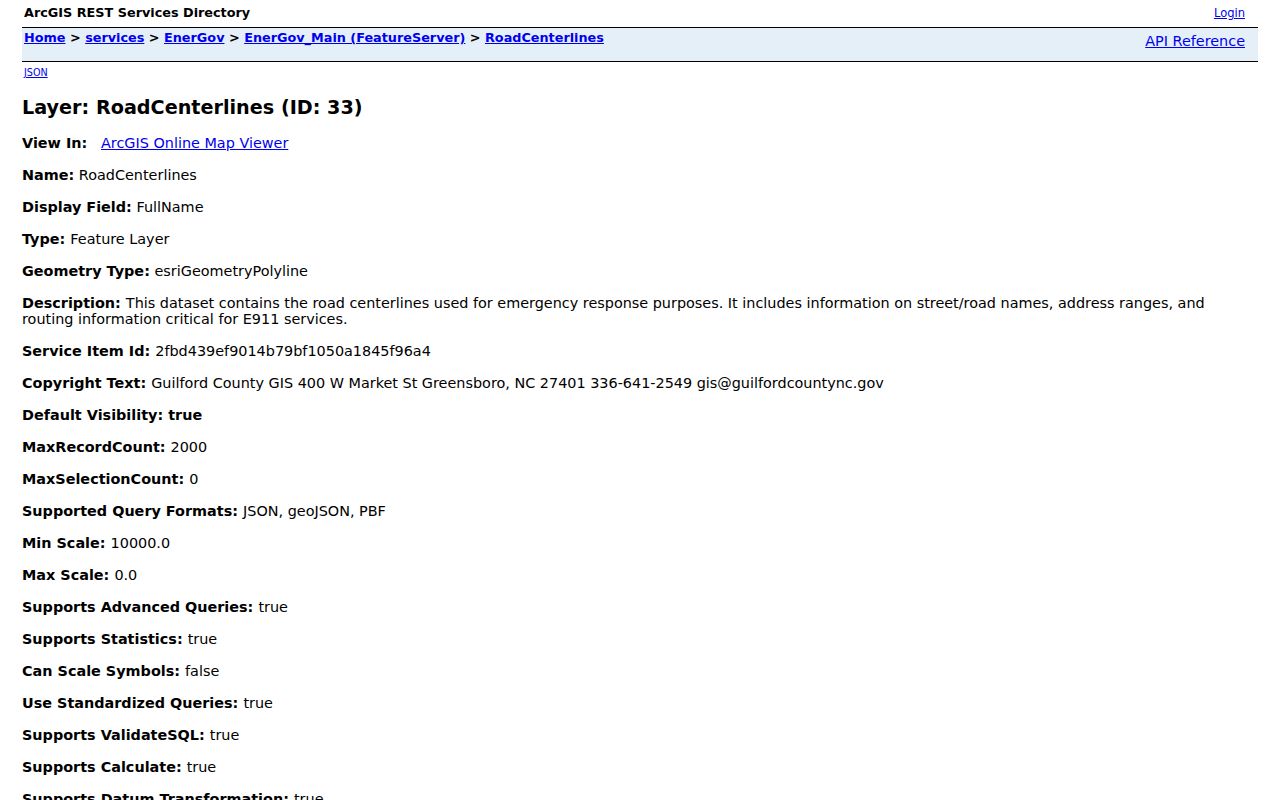
A postal label is therefore not a city-limit finding. Compare the address point, parcel, postal community, and municipality when a street sits near Greensboro, High Point, Kernersville, or an unincorporated community.
Note: The live Primary Data Viewer is a JavaScript map shell, so its full layer, identify, measure, and selection controls were not verified in the research capture.
Guilford County Deeds From Parcels
After an address yields a parcel, search the present owner as a grantee in the Register of Deeds real-estate search. Read the resulting instrument for the grantor, recording date, book, page or document reference, legal description, parcel reference, and any linked earlier instrument. Then search that grantor as a grantee in the prior transfer. A trust, estate, corporation, spouse, or initials may require a separate name path. Match the legal description or plat at each turn rather than relying only on a street number.
The text-rendered deed portal showed unnamed inputs, notices, and JavaScript-controlled controls, but not dependable labels, dropdown values, dates, or a result row. The Register confirms 1771-forward index and image access, yet the exact online image path for any older instrument can vary. If the portal does not produce the needed record, the office books and Greensboro Public Library deed microfilm, covering 1771 through 1922, remain practical routes.
The Register's recording and real-estate information explains its recording standards and copy fees.
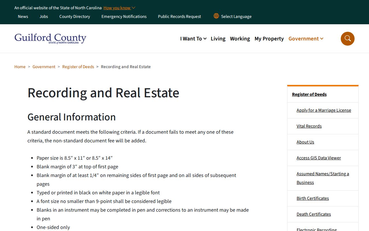
Regular in-house copies are listed at five cents per page, mail copies at one dollar, maps at fifty cents, and certified copies at five dollars for the first page plus two dollars for each additional page. The Register can correct an indexing error, but not rewrite an error contained in an original instrument.
Guilford County Street Work Dates
Permits can add dates to the physical history of an address. The county ArcGIS permit fields include permit number, parcel number, application type, permit type, work class, permit address, total square feet, total valuation, application date, finalization date, and county or system IDs. Greensboro's inspection guidance uses an address or permit number, and says that inspections are not scheduled for the same day. Jurisdiction matters because permit coverage is not one countywide record set.
A permit establishes that work was applied for, reviewed, or finalized in a stated period. It does not establish who was living at the address or whether an applicant owned the parcel. If an address lies near a city or county boundary, confirm the correct inspection custodian with GIS before looking for a permit or requesting a code record. No single countywide code-case search was found in the research.
Guilford County Voter Address Limits
The NC Voter Search is name-driven. Its visible fields are first name, middle initial, last name, optional year of birth, optional county, and Registered, Removed, or Denied status choices. Results may supply jurisdictions, polling place, sample ballot, absentee information, and voting history when available. The public voter-file categories in North Carolina include residence address, age rather than full date of birth, precinct, district, party, and voting history, while sensitive identifiers are protected.
For a street directory, a voter result may confirm a registration record at an address. It does not prove present physical presence, include every person in a household, or replace the parcel and deed trail. Address Confidentiality Program participants can have their actual address protected. Removed or Denied is an election-record status, not a conclusion about a person. Use official request channels where a lawful, specific need calls for data beyond the public lookup.
Note: The Guilford Board of Elections reports a standard 7 to 10 business day response for registration, history, and statistical data requests.
Guilford County Historical Street Clues
Older addresses require more than a modern street search. A legal description can remain stable while a road name or number changes. RoadCenterlines preserves legacy-name information and date fields, while recorded plats can bridge a lot or block to a present parcel. Greensboro Records Management holds street-closing, name-change, annexation, tax-map, and aerial material that can help when an address disappears from a modern search. The research did not identify a verified countywide renumbering year, so none should be assumed.
For a past listing, use the address in a reverse directory and compare it with the parcel and deed description. Greensboro directories run from 1879/80 to 1982 with gaps, and later or suburban material remains in local collections. High Point's first directory was published in 1908, with printed High Point directories from 1910 forward at the Heritage Research Center. These sources offer historical context, not a substitute for current property records.
Guilford County Street Directory Limits
A tax mailing address is not the situs address, and neither proves who occupies a property. A bill can go to an owner, agent, trust, business, estate, or another address. A deed party can have sold, inherited, or never lived at the parcel. GIS and address points describe location. Permit applications describe work. Historical directories apply to their publication dates and inclusion rules. Keep those roles separate rather than turning several partial records into a claim about a household.
Private utility, delivery, and motor-vehicle address records are not open substitutes. Restricted court material, protected voter data, and Address Confidentiality Program addresses also remain outside the public trail. A blank online result can reflect a name variant, a portal limitation, a missing historical index, or a protected record. The appropriate response is to verify the parcel, deed, or official office route, not to infer a fact that the record does not state.
Lawful use. Use Guilford County address records for personal, lawful research and civic or family-history questions. Do not use any record trail to stalk, harass, intimidate, or harm another person.